Around the globe, conservationists, scientists, and grassroots organizations are turning to advanced technology to safeguard threatened species and fragile ecosystems. The challenges are immense—poaching, habitat loss, pollution, and climate change are accelerating faster than traditional conservation methods can handle. To keep pace, environmental defenders are embracing smart, data‑driven solutions that monitor wildlife in real time, predict emerging threats, and make scarce resources work harder on the ground.
A new generation of different AI platforms is rapidly transforming the way we protect animals, from remote rainforests to busy shipping lanes. By analyzing complex data at unprecedented speed, these systems help conservation teams detect patterns humans would miss, anticipate risks before they escalate, and make evidence‑based decisions under pressure. Below are some of the most impactful ways this technology is being used right now to defend wildlife and the habitats they depend on.
1. Acoustic Monitoring Systems That Hear Animals Before We See Them
Many species are elusive or live in environments where human access is limited—dense forests, deep oceans, or remote mountains. Acoustic monitoring systems deploy networks of microphones or hydrophones that continuously record environmental soundscapes. Machine‑learning models then process thousands of hours of audio, identifying species by their calls and flagging unusual sounds that may indicate danger.
These systems can track the presence of rare birds in rainforests, detect bat populations near wind farms, or monitor whales in shipping lanes. By automatically classifying sounds and filtering noise, they help researchers map migration routes, evaluate population trends, and adjust conservation strategies quickly. Teams can act sooner when they hear the first warning signs—such as chainsaws, gunshots, or boat engines in protected areas—rather than relying on slow, manual surveys.
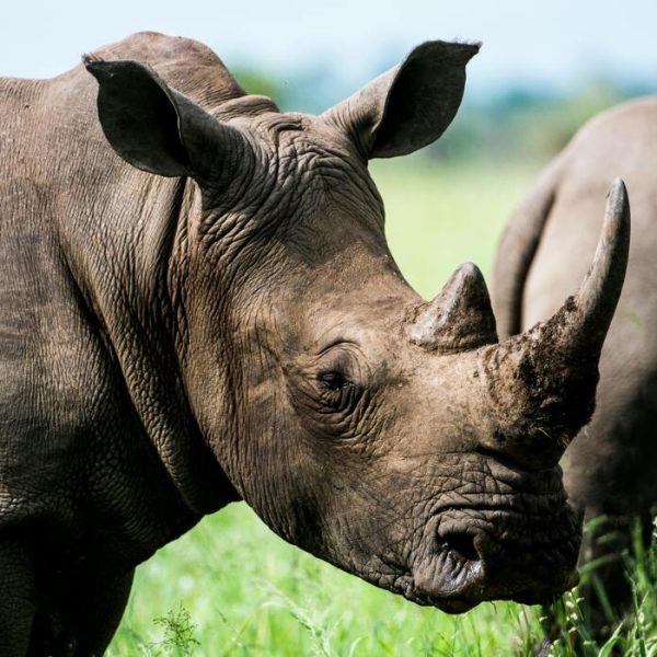
2. Camera Traps and Smart Vision for Poaching Prevention
Camera traps are a staple of wildlife research, but reviewing millions of images is time‑consuming and costly. Smart vision solutions use image recognition models to automatically scan photos and videos, identify species, and even detect humans or vehicles entering restricted zones. This dramatically speeds up analysis and turns passive monitoring into a real‑time alert system.
For endangered species like tigers, rhinos, and elephants, every minute counts when poachers enter protected reserves. Smart cameras can send instant notifications to rangers’ smartphones or control centers, allowing patrols to be deployed precisely where they’re needed. At the same time, researchers gain accurate, high‑resolution data on species distribution, behavior, and population health, enabling better long‑term management plans.
3. Predictive Analytics to Map Poaching Hotspots
Poaching rarely happens at random. It follows patterns related to geography, season, market demand, and enforcement strength. Predictive analytics platforms ingest historical poaching incidents, patrol logs, terrain data, and even satellite imagery to forecast where illegal activity is most likely to occur next.
With this insight, conservation organizations can prioritize patrol routes, position rapid‑response teams strategically, and allocate surveillance resources far more efficiently. Instead of reacting after animals have been killed, teams work proactively, focusing on high‑risk areas before crimes occur. Over time, these models can adapt as poachers change tactics, ensuring enforcement remains one step ahead.
4. Drones and Aerial Monitoring Guided by Smart Algorithms
Unmanned aerial vehicles (UAVs) have become powerful allies for rangers and scientists. Equipped with high‑resolution cameras, thermal sensors, or multispectral imaging, drones provide detailed views of remote habitats without disturbing the animals below. Smart routing and analysis systems determine where and when drones should fly, minimizing battery usage while maximizing coverage.
Aerial monitoring can quickly spot illegal logging, encroaching settlements, or suspicious nighttime movements in protected areas. It also helps track large animal herds across vast savannas, supporting anti‑poaching teams and ecological research at the same time. Automated detection algorithms can flag potential threats or injured animals in the footage, enabling a rapid and targeted response from conservation staff on the ground.
5. Satellite Imaging and Habitat Change Detection
Habitat loss is one of the leading drivers of species decline. High‑resolution satellite imagery combined with automated change‑detection models allows environmental groups to monitor forests, wetlands, and coastlines at global scale. These systems can pick up subtle, early‑stage changes that would be invisible to the naked eye.
By comparing new images against historical baselines, conservationists can see where deforestation, mining, or agricultural expansion is accelerating. They can also track the restoration of areas under reforestation projects and verify whether legal protections are being respected. Early detection of damaging trends gives policymakers, communities, and NGOs the opportunity to intervene before ecosystems cross critical thresholds.
6. Marine Protection: Detecting Ships, Nets, and Whales
Oceans pose unique monitoring challenges, but they are home to some of the most vulnerable species on the planet. Advanced systems combine ship tracking data, weather patterns, and historical fishing records to identify illegal, unreported, and unregulated (IUU) fishing activity. These tools can highlight suspicious vessel behavior, flagging potential violations of marine protected areas in near real time.
In parallel, computer vision and acoustic systems help prevent ship strikes on whales and other large marine animals. They analyze visual imagery, sonar data, or underwater acoustics to locate animals and alert ship captains or port authorities. Routing adjustments, speed reductions, and temporary exclusion zones can then be implemented to reduce collisions and noise pollution that disrupts marine life.
7. Disease Surveillance and Health Monitoring in Wildlife
Disease outbreaks can devastate animal populations and sometimes jump to humans. Smart analytics help conservationists and veterinarians detect early signs of disease by integrating field observations, lab test results, climate data, and movement patterns from tagged animals. Models highlight unusual clusters of illness or mortality and uncover environmental factors driving those trends.
This proactive approach is critical for species already under pressure from habitat loss or climate stress. Early detection allows targeted vaccination campaigns, quarantine measures, or habitat interventions that can stop an outbreak before it spreads. It also strengthens “One Health” initiatives that recognize the interconnected wellbeing of people, animals, and ecosystems.
8. Community‑Centric Platforms for Data Collection and Advocacy
Many of the most effective conservation efforts are rooted in local communities—indigenous groups, fishers, farmers, and volunteers who know the land and wildlife intimately. Modern platforms empower these communities by simplifying data collection and turning their observations into actionable insights.
Mobile apps can guide rangers through standardized patrol reports, record sightings with GPS and photos, and synchronize information into central dashboards. Analytical layers then highlight trends in threats and successes in protection. This not only improves on‑the‑ground decision‑making, it also strengthens advocacy efforts by providing verifiable evidence to policymakers, donors, and the wider public.
Conclusion: Turning Data into Real Protection for Animals
As threats to biodiversity intensify, conservation cannot rely on intuition and scattered data alone. Smarter, connected systems are enabling teams across the world to monitor species more accurately, predict risks more reliably, and respond more rapidly when animals are in danger. From acoustic monitoring and camera traps to drones and satellite imaging, these tools act as force multipliers for the people dedicating their lives to protecting wildlife.
The future of animal protection will be shaped by how effectively we combine local knowledge, scientific research, and powerful analytical platforms. Organizations that embrace this synergy are already seeing tangible gains: fewer poaching incidents, better‑protected habitats, and more informed policy decisions. By investing in these capabilities and ensuring they are accessible to conservationists on the front lines, we have a far better chance of preserving the planet’s most vulnerable species for generations to come.